| diagram | 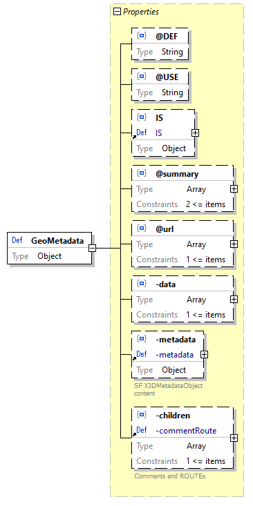 |
||||||||||||||||||
| location | C:\x3d-code\www.web3d.org\specifications\x3d-3.3-JSONSchema.json | ||||||||||||||||||
| type | Object | ||||||||||||||||||
| properties |
|
||||||||||||||||||
| used by | Scene / -children > array items [0]+ / Schema / GeoMetadata -allNodes > array items [0]+ / Schema / GeoMetadata -child / GeoMetadata -children > array items [0]+ / Schema / GeoMetadata -watchList > array items [0]+ / Schema / GeoMetadata |
||||||||||||||||||
| source code | "GeoMetadata": { "type": "object", "properties": { "@DEF": { "type": "string" }, "@USE": { "type": "string" }, "IS": { "$ref": "#/definitions/IS" }, "@summary": { "type": "array", "minItems": 2, "items": { "type": "string" } }, "@url": { "type": "array", "minItems": 1, "items": { "type": "string", "format": "uri-reference" } }, "-data": { "type": "array", "minItems": 1, "items": { "type": "object", "properties": { "GeoCoordinate": { "$ref": "#/definitions/GeoCoordinate" }, "GeoElevationGrid": { "$ref": "#/definitions/GeoElevationGrid" }, "GeoLocation": { "$ref": "#/definitions/GeoLocation" }, "GeoLOD": { "$ref": "#/definitions/GeoLOD" }, "GeoOrigin": { "$ref": "#/definitions/GeoOrigin" }, "GeoPositionInterpolator": { "$ref": "#/definitions/GeoPositionInterpolator" }, "GeoProximitySensor": { "$ref": "#/definitions/GeoProximitySensor" }, "GeoTouchSensor": { "$ref": "#/definitions/GeoTouchSensor" }, "GeoTransform": { "$ref": "#/definitions/GeoTransform" }, "GeoViewpoint": { "$ref": "#/definitions/GeoViewpoint" }, "ProtoInstance": { "$ref": "#/definitions/ProtoInstance" } }, "additionalProperties": false } }, "-metadata": { "$ref": "#/definitions/-metadata" }, "-children": { "$ref": "#/definitions/-commentRoute" } }, "additionalProperties": false } |
Property GeoMetadata / @DEF
| diagram | 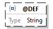 |
||
| property details |
|
||
| type | String | ||
| source code | "@DEF": { "type": "string" } |
Property GeoMetadata / @USE
| diagram | 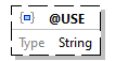 |
||
| property details |
|
||
| type | String | ||
| source code | "@USE": { "type": "string" } |
Property GeoMetadata / IS
| diagram | 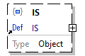 |
||
| property details |
|
||
| reference | IS | ||
| source code | "IS": { "$ref": "#/definitions/IS" } |
Property GeoMetadata / @summary
| diagram | 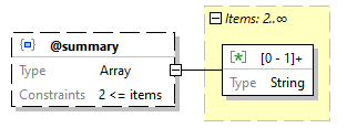 |
||
| property details |
|
||
| type | Array | ||
| array constraints |
|
||
| array items |
|
||
| source code | "@summary": { "type": "array", "minItems": 2, "items": { "type": "string" } } |
Array item wildcard GeoMetadata / @summary > array items [0]+ / Schema
| diagram | 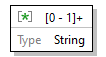 |
| type | String |
| source code | { "type": "string" } |
Property GeoMetadata / @url
| diagram | 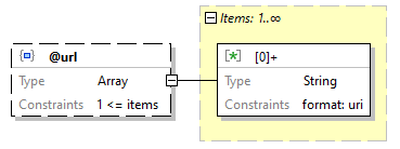 |
||
| property details |
|
||
| type | Array | ||
| array constraints |
|
||
| array items |
|
||
| source code | "@url": { "type": "array", "minItems": 1, "items": { "type": "string", "format": "uri-reference" } } |
Array item wildcard GeoMetadata / @url > array items [0]+ / Schema
| diagram | 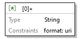 |
||
| type | String | ||
| string constraints |
|
||
| source code | { "type": "string", "format": "uri-reference" } |
Property GeoMetadata / -data
| diagram | 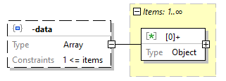 |
||
| property details |
|
||
| type | Array | ||
| array constraints |
|
||
| array items |
|
||
| source code | "-data": { "type": "array", "minItems": 1, "items": { "type": "object", "properties": { "GeoCoordinate": { "$ref": "#/definitions/GeoCoordinate" }, "GeoElevationGrid": { "$ref": "#/definitions/GeoElevationGrid" }, "GeoLocation": { "$ref": "#/definitions/GeoLocation" }, "GeoLOD": { "$ref": "#/definitions/GeoLOD" }, "GeoOrigin": { "$ref": "#/definitions/GeoOrigin" }, "GeoPositionInterpolator": { "$ref": "#/definitions/GeoPositionInterpolator" }, "GeoProximitySensor": { "$ref": "#/definitions/GeoProximitySensor" }, "GeoTouchSensor": { "$ref": "#/definitions/GeoTouchSensor" }, "GeoTransform": { "$ref": "#/definitions/GeoTransform" }, "GeoViewpoint": { "$ref": "#/definitions/GeoViewpoint" }, "ProtoInstance": { "$ref": "#/definitions/ProtoInstance" } }, "additionalProperties": false } } |
Array item wildcard GeoMetadata / -data > array items [0]+ / Schema
| diagram | 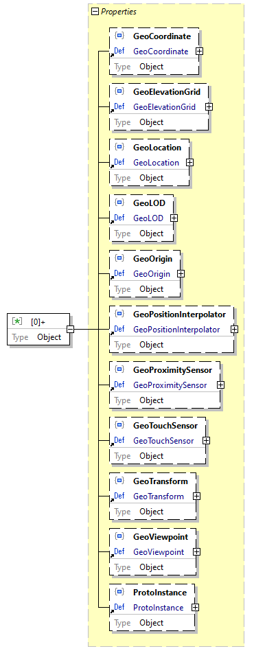 |
||||||||||||||||||||||||
| type | Object | ||||||||||||||||||||||||
| properties |
|
||||||||||||||||||||||||
| source code | { "type": "object", "properties": { "GeoCoordinate": { "$ref": "#/definitions/GeoCoordinate" }, "GeoElevationGrid": { "$ref": "#/definitions/GeoElevationGrid" }, "GeoLocation": { "$ref": "#/definitions/GeoLocation" }, "GeoLOD": { "$ref": "#/definitions/GeoLOD" }, "GeoOrigin": { "$ref": "#/definitions/GeoOrigin" }, "GeoPositionInterpolator": { "$ref": "#/definitions/GeoPositionInterpolator" }, "GeoProximitySensor": { "$ref": "#/definitions/GeoProximitySensor" }, "GeoTouchSensor": { "$ref": "#/definitions/GeoTouchSensor" }, "GeoTransform": { "$ref": "#/definitions/GeoTransform" }, "GeoViewpoint": { "$ref": "#/definitions/GeoViewpoint" }, "ProtoInstance": { "$ref": "#/definitions/ProtoInstance" } }, "additionalProperties": false } |
Property GeoMetadata / -data > array items [0]+ / Schema / GeoCoordinate
| diagram | 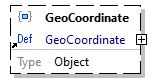 |
||
| property details |
|
||
| reference | GeoCoordinate | ||
| source code | "GeoCoordinate": { "$ref": "#/definitions/GeoCoordinate" } |
Property GeoMetadata / -data > array items [0]+ / Schema / GeoElevationGrid
| diagram | 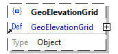 |
||
| property details |
|
||
| reference | GeoElevationGrid | ||
| source code | "GeoElevationGrid": { "$ref": "#/definitions/GeoElevationGrid" } |
Property GeoMetadata / -data > array items [0]+ / Schema / GeoLocation
| diagram |  |
||
| property details |
|
||
| reference | GeoLocation | ||
| source code | "GeoLocation": { "$ref": "#/definitions/GeoLocation" } |
Property GeoMetadata / -data > array items [0]+ / Schema / GeoLOD
| diagram |  |
||
| property details |
|
||
| reference | GeoLOD | ||
| source code | "GeoLOD": { "$ref": "#/definitions/GeoLOD" } |
Property GeoMetadata / -data > array items [0]+ / Schema / GeoOrigin
| diagram |  |
||
| property details |
|
||
| reference | GeoOrigin | ||
| source code | "GeoOrigin": { "$ref": "#/definitions/GeoOrigin" } |
Property GeoMetadata / -data > array items [0]+ / Schema / GeoPositionInterpolator
| diagram |  |
||
| property details |
|
||
| reference | GeoPositionInterpolator | ||
| source code | "GeoPositionInterpolator": { "$ref": "#/definitions/GeoPositionInterpolator" } |
Property GeoMetadata / -data > array items [0]+ / Schema / GeoProximitySensor
| diagram |  |
||
| property details |
|
||
| reference | GeoProximitySensor | ||
| source code | "GeoProximitySensor": { "$ref": "#/definitions/GeoProximitySensor" } |
Property GeoMetadata / -data > array items [0]+ / Schema / GeoTouchSensor
| diagram |  |
||
| property details |
|
||
| reference | GeoTouchSensor | ||
| source code | "GeoTouchSensor": { "$ref": "#/definitions/GeoTouchSensor" } |
Property GeoMetadata / -data > array items [0]+ / Schema / GeoTransform
| diagram |  |
||
| property details |
|
||
| reference | GeoTransform | ||
| source code | "GeoTransform": { "$ref": "#/definitions/GeoTransform" } |
Property GeoMetadata / -data > array items [0]+ / Schema / GeoViewpoint
| diagram |  |
||
| property details |
|
||
| reference | GeoViewpoint | ||
| source code | "GeoViewpoint": { "$ref": "#/definitions/GeoViewpoint" } |
Property GeoMetadata / -data > array items [0]+ / Schema / ProtoInstance
| diagram | 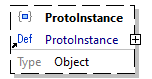 |
||
| property details |
|
||
| reference | ProtoInstance | ||
| source code | "ProtoInstance": { "$ref": "#/definitions/ProtoInstance" } |
Property GeoMetadata / -metadata
| diagram | 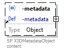 |
||
| property details |
|
||
| reference | -metadata | ||
| source code | "-metadata": { "$ref": "#/definitions/-metadata" } |
Property GeoMetadata / -children
| diagram | 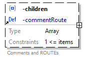 |
||
| property details |
|
||
| reference | -commentRoute | ||
| source code | "-children": { "$ref": "#/definitions/-commentRoute" } |
JSON Schema documentation generated by XMLSpy JSON Schema Editor http://www.altova.com/xmlspy/json-schema-editor.html